
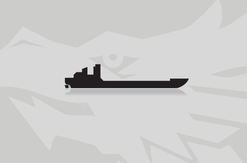
LOUISE
Course/Position

Latest ports
Latest Waypoints
Latest news
Neches River reopened with restrictions
The Coast Guard has reopened the Neches River with restrictions to all vessel traffic on Aug 22, 2015. The vessel traffic was restricted from meeting or overtaking one another 1,000 feet up bound and 1,000 feet down bound near the "Louise" at mile marker 284. Additionally, mariners are cautioned to create a minimum wake for the safety of salvage and recovery crews. A minimal sheen was reported on scene; however hard boom, lined with absorbent boom was containing it. Salvage divers report all possible pollution sources have been plugged to prevent additional leakage. The tug had the potential to release 6,000 gallons of fuel oil, 70 gallons of lubricant oil, and 30 gallons of hydraulic fluid. A barge containing heavy equipment and a crane was in place to stabilize the sunken vessel. The Coast Guard was working with the vessel owners to devise an optimal plan for the its safe removal. The Coast Guard had established a safety zone on the Neches River after the "Louise" capsized near Port Arthur on Aug 21. The safety zone was in place between mile markers 276 to 289. The Coast Guard received notice, at approximately 6:45 p.m. that the "Louise" had capsized in the Neches River near mile marker 284. The four crewmembers aboard the tug were rescued by a Good Samaritan tug boat operator, with no reported injuries. Reports with photos: http://www.uscgnews.com/go/doc/4007/2587338/ http://www.uscgnews.com/go/doc/4007/2587430/
Tug Louise capsized on Neches River near Port Arthur
Tug Louise capsized in Neches river, Port Arthur, US, Gulf of Mexico, on Aug 21, 4 crew rescued. Fuel and lubricants on board started to leak, cleaning is under way, a safety zone was established around the capsized vessel.
Upload News